
Edited by:
Massimo Martini
Edited by:
Massimo Martini
Exit the motorway toll booth at Aosta Ovest and, after 450m (0.45km), take the junction for the regional road towards the state road . At the next roundabout, after a further 400m (0.85km), take the second exit to join the state road in the Aosta Valley. Follow the for approximately 3 km (3.85 km), passing through the village of Saint-Pierre until you reach the village of Luboz. Turn right onto Via Corrado Gex and follow it for 300m (4.15km), then turn right again onto the regional road , which you should follow for approximately 7.7km (11.85km) to Saint-Nicolas. Just past the centre, at a junction, carry on straight ahead on the regional road , following the signs for Vétan, for 1.0 km (12.85 km) to Petit Sarriod. Once in Petit Sarriod, leave the and turn left onto the local road that passes through the villages of Person, Grand-Sarriod and Gerbore. Follow this road for 4.2 km (17.05 km) to Vétan Villette, where the road ends at a large car park.
In Vétan Villette, there is a free 🅿️ car park at the end of the local road, in front of the Hotel Notre Maison — the starting point of the route.
To reach the starting point of the route, you will need a private vehicle, as the village is not served by public transport.
🕒 Journey time: 29 minutes
📏 Distance: 18.2 km
The directions provided were verified on the date the route was mapped. Before setting off, we recommend checking for any changes to the route or road conditions. For up-to-date information, please consult Google Maps or Apple Maps.
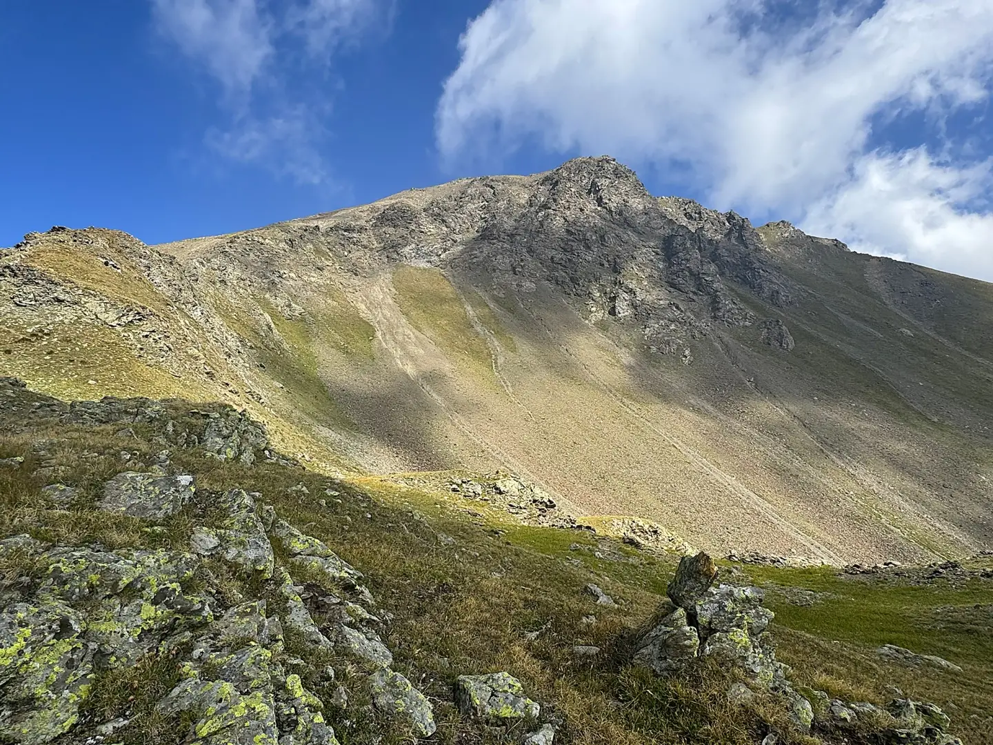
Ascent of Monte Rosso di Vertosan, the highest peak in the Monte Fallère range which forms the northern boundary of the Vertosan valley, starting from Vétan Villette, a hamlet of Saint-Pierre. The route passes through a short larch forest and the wide pastures above thevillage, passes the Thoules mountain pasture and climbs up the Verrogne valley along a farm track dotted with wooden sculptures by Siro Vierin and the statue dedicated to Abbé Cerlogne. Once past the farm track, the landscape changes character: the path, which becomes increasingly less marked, leaves the pastures behind and heads towards the scree slope and the debris-strewn ridge descending from the southern crest of Monte Rosso, with the Château Blanc glacier visible behind you throughout the ascent. A few short sections over rocky outcrops and the crossing of a scree slope precede the final ridge, which is open and presents no real technical difficulties, leading to the summit. From here, the view opens up to a 360° panorama of the entire region, with the Mont Blanc massif marking the north-western horizon.
The recommended time of year is July, when alpine flowers bring the pastures and small valleys crossed during the first part of the route to life. The descent follows the same route as the ascent: the elevation gain and difficulty are concentrated in the upper section, and the final stretch requires that there be no remaining snow on the scree and ridge, as well as a minimum level of experience in high-mountain terrain.
0h00' 0.00km Head towards the yellow signposts, which indicate the main routes in the area, and take the path. After a few metres, the path runs alongside a refreshment point selling fresh cheeses. Continue up the steep climb through the short larch forest (Larix decidua), ignoring the turn-off on the left for the chapel dedicated to John Paul II – which you can visit on your return if you wish – and reach the large pasture, where you’ll find another signpost.
0h05' 0.16km Ignore the Cammino Balteo on the left and take the path on the right, immediately after the first of the many wooden structures that accompany walkers to the Mont Fallère refuge. Cross the Vétan stream via a wooden footbridge and continue along the pastures, with a few short ascents and descents. Then turn left and tackle a short climb, skirting a stream until you reach a new signpost at an altitude of 1,890m, just below the Thoules mountain pasture, situated at 1,929m.
0h20' 0.88km (110 m ascent) (0 m descent) Keep to the right and follow the level path, which crosses the first moraine ridge descending from Punta Leysser and marks the boundary of the Méod valley. Cross the watershed, looking out for Siro Vierin’s works amongst the branches and along the path, then follow the second ridge until you reach another signpost.
0h45' 2.04km Ignore the path to Alpe Loé on the right and climb up the wooded slope, which is quite steep: this is the steepest section of the ascent to the refuge. Towards the end of the ascent, the woodland thins out, offering views of the Château Blanc glacier and the surrounding peaks. Once out of the woodland, you reach the farm track near a bench.
1h30' 3.15km (436 m elevation gain) (1 m elevation loss) Turn right and follow the farm track, which, with a moderate gradient, leads into the Verrogne valley. Deer, wolves, wild boars and other woodland animals, depicted in a series of wooden sculptures, line the path alongside the statue of Abbé Cerlogne, the father of Franco-Provençal poetry in the Aosta Valley. The track then leaves the mountainside and looks out over the valley near a signpost, at an altitude of 2,299m.
1h50' 4.16km (530 m ascent) (1 m descent) Turn left and take the path, which is clearly marked at first but gradually becomes less distinct, initially running alongside a small stream. After a short climb, go over a grassy hump, then turn left and enter a small valley. Follow it all the way until you reach the junction with path , coming from the Mont Fallère refuge.
2h15' 5.16km Turn left and follow the path for a short distance as it climbs gently, until you come to a metal signpost marked ‘Monte Rosso’.
2h20' 6.51km (944 m elevation gain) (10 m elevation loss) Turn right and follow a faint track up a short gully until you come to two yellow arrows indicating you should turn right again. Continue for a stretch halfway up the slope, diagonally and slightly uphill, skirting a grassy ridge. Then continue up steeper slopes, following the path – which is fairly obvious thanks to the yellow arrows and a few cairns – until you reach a short, level stretch. From here begins the ascent of the highest section of the ridge descending from the summit ridge. After passing a few short sections over small rocks, you reach a section of the slope crossed by a gully. At this point, the going becomes slightly more challenging, but remains free of any particular difficulties. Cross the gully and make your way onto the final ridge. Turn right, passing to the right of some rocky outcrops, and reach a notch in the rocky ridge at an altitude of 2,794 m. Then ascend the ridge to the right – initially gently sloping – towards a predominantly stony ridge where the gradient increases significantly, until you reach a large cairn on scree and loose rock. Pass the secondary summit, at 2,933 m, a few tens of metres from the main summit, and carefully follow the distinct little ridge path separating it from the main summit, up to the summit of Monte Rosso di Vertosan (2,940 m). 3h30' 6.82km
The return follows the same route taken on the way up. 1h55' 6.82km (1 m elevation gain) (1,161 m elevation loss)
Edited by:
Massimo Martini
Comments (0)
Sign in to leave a comment